Bailiffs & Boundaries: History in the Landscape
This is a blog about how a18th century map, a 7th century abbess and folklore collection on the 19th century may hold clues about an old processional route across the South Shropshire hills.

The ‘Map of the Wastes of Earnstrey’ was made back in 1712 and shows a number of ‘gospel places’ marked at intervals across the top of Brown Clee, the tallest of the Clee Hills in Shropshire. Gospel places are where gospels were read, often local landmarks, to spread God’s word and reach out to the laity tending to belong to the medieval past. These are absent from later maps of the area suggesting they belonged to an earlier time and were not worth recording by the late 1700s.
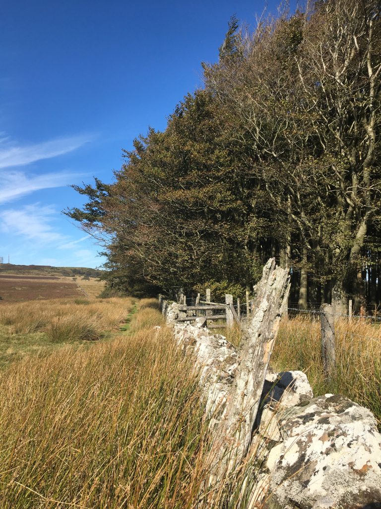
I came across the map earlier this summer during volunteer work for the Uplands Commons Project (led by the Foundation for Common Land this projects aims to secure the future of England’s few remaining commons). I was part of a team excavating bell pits and remnants of a parish boundary walls with possible medieval origins on Abdon Burf’s neighbouring the neighbouring summit, Clee Liberty. While researching in the archives for clues regarding ancient boundary markers I came across these ‘gospel places’ on the Earnstrey map. There was no way of knowing whether they continued as a series over Clee Liberty and struck me as curious places to hear the gospels read.
The Priory of Much Wenlock, twenty miles away, has an historic connection in these parts with Brown Clee, mainly due to its acquisition in Saxon times of the parish of Stoke St Milborough, a village the other side of Clee Liberty. I was curious to explore any possibility of a relationship between these ‘gospel places’ and this most southerly parish of the priory. Are these fading points on a map all that is left of an old processional route from Much Wenlock over Abdon Burf and Clee Liberty to Stoke St Milborough?
Bailiffs, Bannering & Boundaries
In Shropshire folklore there is a curious little rhyme which recites five parishes in the ‘old franchise’ of Much Wenlock. It was found in an old letter by the Reverend George Henry Hartshorne, Shropshire writer and antiquarian, and included in his Salopia Antiqua published 1841. Forty years later folklorist Charlotte Burne noted that the rhyme was just about remembered in Wenlock but its original form and purpose was forgotten. It goes as follows,
We go from Beckbury and Badger and Stoke on the Clee
to Monkhopton, Round Acton and so return we
Both Reverend Hartshorne and Mrs Burne agreed the rhyme likely referred to the old custom of ‘bannering’, more commonly known as ‘beating the bounds’: ‘An annual custom of perambulating the borders of a parish. On which occasion a number of boys headed by the inferior parochial authorities, walk round its boundaries, for the purpose of maintaining the local jurisdiction and privileges’. C. H. Hartshorne, Salopia Antiqua, 1841).
The local clerk who had written the letter explained that the rhyme belonged to an old Wenlock custom called the ‘Boy’s Bailiff’ and was for ‘going a bannering the extensive boundaries of the franchise’. The ‘Boy’s Bailiff’, he wrote, was last held in the late 1700s some time around Whitsun, the traditional time for ‘beating the bounds’. He described it as follows:
‘It consisted of a man who wore a hair-cloth gown and was called the bailiff, a recorder, justices, town clerk, sheriff, treasurer, crier and other municipal officers. They were a large retinue of men and boys mounted on horseback, begirt with wooden swords which they carried on their right sides so they must draw out of their scabbards with their left hands. They, when I knew them, did not go to the boundary but used to go to all the gentlemen’s houses in the franchise where they were regaled with meat, drink and money; and before the conclusion they assembled at the pillory at the Guildhall where the town clerk read some rigmarole they called their charter…..’
Bannering/Beating the Bounds
This remnant of rhyme may hark back to a old tradition from the early medieval period. Both secular and religious members of the community would walk in procession reciting prayers and blessing the fields in hope of a good harvest. This took place sometime after Easter and before Ascension Day, forty days after Easter. There were similar pre-Christian festivals which also celebrated the new season albeit in less austere fashion.

By the Middle Ages these processions had become affirmations of local community boundaries. Local landmarks were used such as large stones, wayside crosses and streams to establish the limits and perimeters of each parish. Even trees were used, for example, there is a medieval reference to a tree in Hereford known as ‘Walter Map’s Oak’ regarding land demarcation.
By the sixteenth century these perambulations were known as Cross or Banner Days, the latter after the custom of carrying banners depicting saints or scenes from Christ’s life. Bells might be rung and hospitality offered, especially by those villages who might benefit from a crop blessing. At certain ‘stations’ the procession would stop for the gospels to be read aloud and prayers to be made. These places were identified by certain natural landmarks or markers such as roadside crosses and sometimes known as ‘gospel places’. Trees survived into the last century with names like ‘Gospel Oak’ or ‘Gospel Yew’. Some survive today.
The Reformation curtailed these seemingly ‘idolatrous’ indulgences but ‘bannering’ survived in secular form as a tour of the parish bounds rather than a religious blessing of the land. The historian Ronald Hutton writes how after the eighteenth century there are few accounts and the historian is ‘reliant instead upon incidental comment and the increasingly abundant surveys of folklorists’. The popularity of bannering seems to have peaked around 1700, followed by a slow decline, hampered by enclosure and cost.
Bannering remained an annual event in Shrewsbury until the mid 1800s. Ludlow retained the religious character of the occasion well into the nineteenth century with people kneeling at the Weeping Cross while the priest read the Gospel (the Weeping Cross, Ludlow, was at the south-east edge of old Ludlow where Weeping Cross Lane meets the River Teme). Burne describes one thus:
‘old-fashioned Rogation-day procession of parish dignitaries bearing long wands with which boundary markers were beaten, the company of little boys who were made to clamber over house roofs and put into odd holes and corners, and not frequently whipped at important points to make them remember…’.
So, to return 1712: Queen Ann was on the throne and England continued to change and reform following the upheavals of Civil War. Much of the old forests had been cleared and the commons were continually subjected to further enclosure, denying access to land people had used for generations. The 1712 map illustrates the land above Earnstrey Park below Abdon Burf with the ‘gospel places’ marked high along Abdon Burf. They appear to run from the direction of Stoke St Milborough and over towards Monkhopton, another parish mentioned in the rhyme. Could these be indicators of early stopping places where the gospel was read during medieval rogation processions around the Wenlock franchise?
Possible Existence of Processional Route from Much Wenlock to Stoke St Milborough.
The Clee Hills have a long and steady history of human occupation since the Neolithic period. Saxon kings hunted in the Clee Forest of which Earnstrey was once part. Abbess Milburga’s brothers gave her land around Stoke and Clee Stanton which became part of the land franchise of Wenlock.* Following the Norman Conquest the land was divided further under ownership of certain Marcher Lords and later the subject of manorial records and alliances.

The provenance of a connection between Stoke St Milborough and Much Wenlock may be found in land acquisition of the eighth century but where does the notion of a bailiff come from? An early reference may be found in the charter granted by Edward IV to the town in 1468 which created the Borough of Wenlock. The town then assumed independence and self-government accordingly being governed by a bailiff elected from and by the burgesses of the town every Michaelmas. It was a huge borough covering at one time 71 square miles running from Little Wenlock to Beckbury, Deuxhill to Stoke St Milborough, Eaton-under-Heywood to Wigwig and Coalbrookdale to Little Wenlock, an administrative nightmare. Subsequently the borough was much reduced by the late nineteenth century and eventually the office of Bailiff was abolished.
It was at the Raven Inn at Much Wenlock in October 1835 that the ‘great and good’ men of the parish, one hundred and fifty of them, gathered for the final ‘Bailiff’s Feast’. Mr William Austice, the last bailiff, raised his glass for the last time acknowledging hundreds of years of history and tradition but stating that now it was time for reform.** In that moment ancient customs and traditions that had evolved and adapted over centuries, covering miles of Shropshire countryside finally ended.
In Conclusion
The parishes in the rhyme were certainly once property of the ancient Priory of St Milburga at Much Wenlock and remained part of its franchise following Edward IV’s charter. However, whatever the custom of the ‘Boy’s Bailiff’ was, it was almost forgotten by the time Charlotte Burne interviewed her sources in the late nineteenth century.
The late town clerk’s reference to the assemblage of a bailiff dressed in hair cloth, of men on horseback, wearing fake swords and visiting ‘gentlemen’s’ houses where they were given food and drink sounds like a remnant of an older tradition. Whether this was performed either in memory or mockery of the earlier event is unknown but it had seemingly been reduced by this time in importance. Time and reformation had, perhaps, taken its toll. The reference to wearing hair cloth is interesting as this was a material used for garments worn by penitents, suggesting a possible medieval provenance. The timing of the ‘Boy’s Bailiff’ was certainly right for ‘bannering’, being held around Whitsun, the time of the medieval Rogationtide processions.
Connections between Wenlock and Stoke St Milborough are well documented with land in the possession of Wenlock Abbey for eight hundred years until its Dissolution in 1540. Given that there are records of lengthy perambulations pre-Reformation it is not impossible there was once a processional route to confirm the boundaries of this ancient parish that stopped at certain ‘gospel places’ high on the windswept, barren summits of Brown Clee as they crossed over from Stoke St Milborough possibly to Middleton or vice versa.
Further research may determine whether this rhyme has a much older, medieval origin. It may be determined whether the ‘gospel places’ identified on the top of Abdon Burf were ancient boundary markers, part of an ancient processional route from the Priory. Alternatively it may be coincidence and the ‘gospel places’ allude to another long forgotten tradition. Either way the exploration of the potential origin and purpose of the little rhyme has opened a window upon a significant part of Shropshire history and tradition.
Pamela Thom-Rowe
*The daughter of Merewalh, 7th ruler of Magonsæte, a sub-kingdom of Mercia gave her name to Stoke St Milborough. Milburga became abbess of her fathers Abbey at Much Wenlock in the 8th century. She recorded in her testament that her abbey had acquired lands in Cle Hill, probably from her brothers who gave the abbey land around Clee Stanton and Stoke. W. F. Mumford, Wenlock in the Middle Ages, pp. 5 – 9, p. 50. For the Life of St. Milburga see Mary Gifford Brown An Illuminated Chronicle. Also Stenton. Trevor Rowley, The Welsh Border, Archaeology, History & Landscape p.136. Stoke St Milborough (Godstok) and Clee Stanton are both associated with Milburgh’s miracles but that’s another story. Milburga’s holy well well remains at Stoke and three miles away is Heath Chapel, once a Chapel of Ease for the medieval parish.
** Salopian Journal, 7 October, 1835.
Please do get in touch should you require any references.

Further reading:
R. Hutton, Stations of the Sun, 1996.
Charlotte Burne, Shropshire Folk-lore, 1883.
Charles, Henry, Hartshorne. Salopia Antiqua, 1841.
Trevor Rowley, The Shropshire Landscape, 1972.
All pictures: P Thom-Rowe